At 15 miles we crossed the Rogue River and began climbing in earnest again for a bit. Pretty views.............
At 16 miles we left the main highway and rode on the lovely and almost traffic-free Mill Creek Drive. Every once in a while we had a glimpse of Mt. McLoughlin in the distance.
At 22 miiles I pulled in to where I figured there would be a SAG stop. I needed to do a little repair work on my bike. The screw holding the battery (for electronic shifting) had worked its way loose and I sure couldn't afford to lose the ability to shift gears. I figure I was lucky to discover that it was loose before it fell out on the road somewhere. The SAG came by in mid-repair but I had the necessary tools with me so I just filled up on water, had a snack and then went for a short hike to see some waterfalls. Apparently I was the only one today to include the hiking option. Mill Creek Falls was 173' high and Barr Creek Falls was 242' high.
Shortly after that the road crossed a creek (I'm guessing Mill Creek) and had this lovely little bridge over it. Must be a thing with Oregon; I remember the lovely bridges we encountered on the Oregon Coast trip.
Typical forest scenery from today...........
We had a nice long SAG stop at Union Creek, mile 34. While many people went in to Beckie's for pie & ice cream, I snacked on the lunch that I had brought along and had a few bites of Linda's cinnamon buns leftovers. Seems after pie & ice cream she couldn't eat the huge cinnamon bun as well.
At 43 miles we crossed the boundary into Crater Lake National Park (no sign). At 4000 feet of climbing we saw the first snow beside the road, and after 5000 feet of uphill the snow was starting to get a bit deeper. I believe they keep the road to the village at the southwest end of the lake open all winter, but the rim road is cleared only in the spring. The section along the west side of the lake to the north entrance is the first opened. This year it was just opened this past week. Thank goodness - if it were not open, we would have had a very long and less scenic day ahead of us on Thursday. The remainder of the rim road (north, east & south) is still closed. When we were through here close to the end of June in 2013 that same section of the rim road was still not open that year.
Crossed the PCT at about 50 miles.
Finally through the offical park entrance at 51 miles. I stopped at a couple of visitor centres on the final stretch - just because I always stop at visitor centres, but also it gave my legs a bit of a break.
The last couple of miles were some of the steepest of the day.
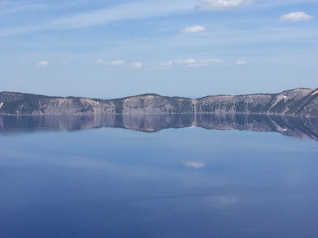
But the reward at the top - priceless!!
Crater Lake is actually not a crater. It is a caldera. Mount Mazama (a volcano) had a huge eruption about 7700 years ago which caused the mountain to collapse, forming a deep caldera. The deep basin filled with centuries of rain and snowfall. No streams run into the lake, so very little sediment clouds its pure waters. Precipitation, balanced with evaporation and seepage, keeps the lake level constant. Wizard Island (last photo above) erupted after the lake began to fill. The lake is the deepest in the US. The deepest point in the lake is 1943 feet. The lake is between 4.5 and 6 miles across and holds 4.9 trillion gallons of water. The lake has only frozen over once in the recent past (1949 I believe). On average, the area receives 44 feet of snow in the winter. The height of the rim above the lake ranges from 507 feet to 1978 feet above lake level. In the summer a tourist boat operates, but it requires a snow-free path down to the lake; might be a while yet.............
We are staying two nights at the Crater Lake Lodge, built in 1915 right at the edge of the lake. Here are some pics from the porch.
A great day today. And even better because 9 of our riders rode the whole thing! A challenging accomplishment for all!!
Stats for the day:
95 km / 59 miles from Shady Cove OR to Crater Lake OR
6435 feet up
749 feet down
Weather: glorious. 8C to about 30C; a bit cooler at the top. Bright sunshine. Perfect weather for the task at hand.


Wow, Sue! That's some reward - beautiful. But my legs hurt just looking at that climbing chart! I wouldn't want to hike that let alone bike it... Good on you!
ReplyDelete